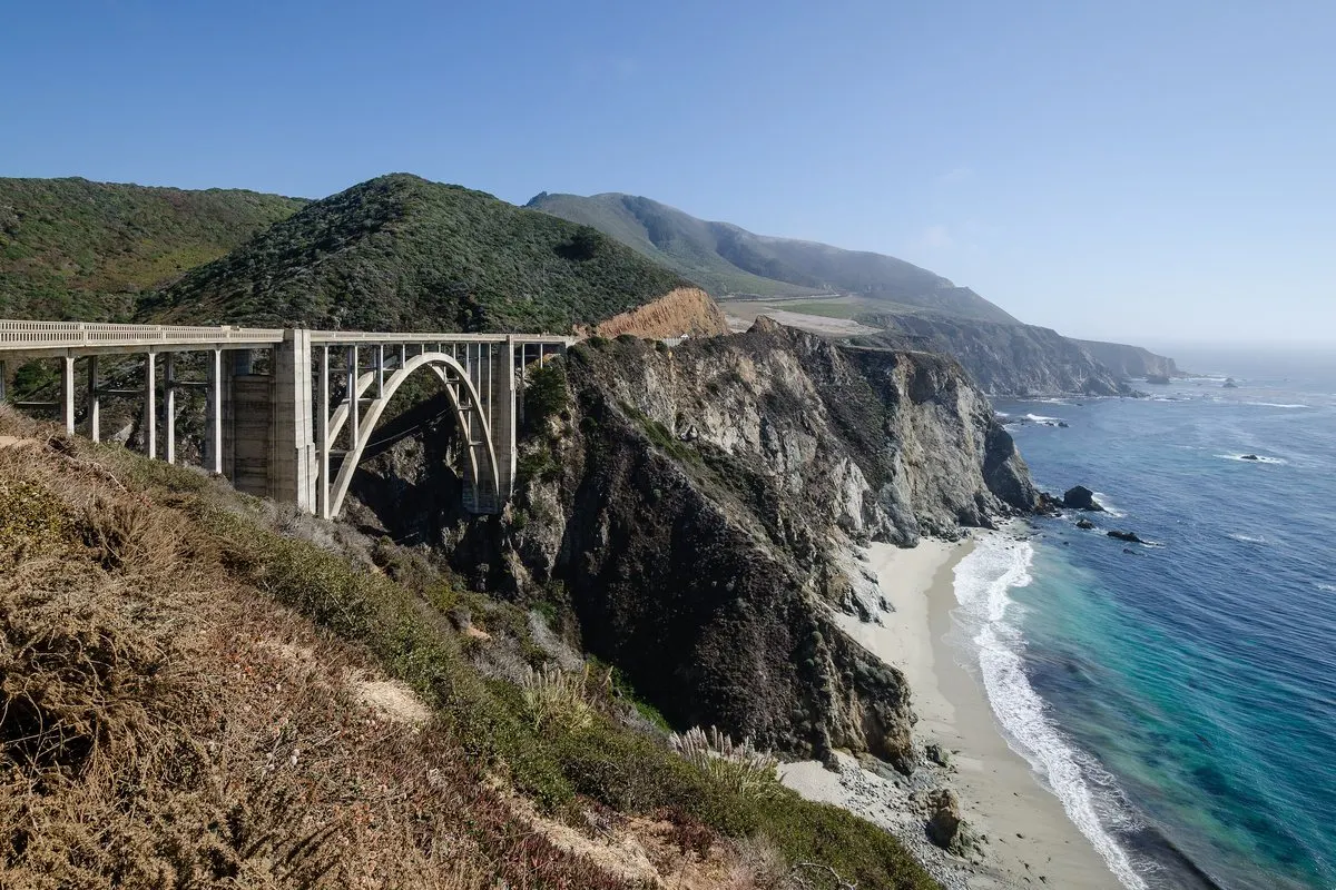
Between Carmel Highlands and San Simeon, the Santa Lucia Mountains drop straight into the Pacific, and a road that took eighteen years to build clings to the cliffs. A day's drive down the Big Sur coast, from the bridge on every postcard to McWay Falls.
In this story · 5 sections
Big Sur is the stretch of California's Central Coast between Carmel Highlands and San Simeon where the Santa Lucia Mountains rise abruptly from the Pacific. It has been called the longest and most scenic stretch of undeveloped coastline in the contiguous United States, and it draws between 4.5 and 7 million visitors a year – comparable to Yosemite – to a coast with only 1,800 to 2,000 year-round residents and four small settlements.
It stays that way by design. The Big Sur Local Coastal Plan of 1986, among the most restrictive land-use documents of its kind, protects the views from the highway and severely limits development; about 60 per cent of the coast is owned by agencies that allow none. The interior is largely national forest and wilderness.
01The road itself
Until the 1930s this was one of the most inaccessible places in the United States. The Carmel–San Simeon Highway, now part of State Route 1, was completed in 1937 after 18 years of construction, and this narrow, winding road, often cut into the face of the cliffs, dominates every visitor's experience. It is also fragile: landslides have closed it more than 55 times. In May 2017 a huge slide at Mud Creek buried the road near the San Luis Obispo County line, and it did not reopen until July 2018. Check Caltrans road conditions before setting out, fill the tank and expect stretches without phone signal.
02Morning: Bixby Creek Bridge
Drive south from Carmel. Within half an hour you reach Bixby Creek Bridge, one of the most photographed bridges in California. Before it opened in 1932, Big Sur residents were virtually cut off each winter, when the inland Old Coast Road became impassable. The reinforced-concrete open-spandrel arch was built under budget for $199,861, and on completion it was the highest single-span arch bridge in the world; it remains one of the tallest. Its two great vertical buttresses are, engineers note, purely decorative.
The land on either side was privately owned until 1988 and 2001; after campaigns by residents and conservationists against logging and subdivision, both pieces were bought by public agencies. Park only in the marked turnouts – the bridge itself is too narrow for stopping.
03Midday: the redwoods of Pfeiffer Big Sur
Continue south to Pfeiffer Big Sur State Park, centred on the Big Sur River and nicknamed a mini Yosemite. Part of its forest is old growth, and a redwood known as the Colonial Tree is estimated to be between 1,100 and 1,200 years old. The Esselen people lived in Big Sur from as early as 3500 BC, wintering on the coast and moving inland in summer and autumn to gather acorns; their mortar holes can still be found in rocks throughout the region. The park takes its name from the Pfeiffer family, who homesteaded here in the nineteenth century.
04Afternoon: McWay Falls
Further south, in Julia Pfeiffer Burns State Park, a short trail leads to the overlook above McWay Falls, a waterfall that runs all year from McWay Creek to the Pacific. At high tide it is a tidefall – one of only two in California. Until 1983 it fell directly into the ocean; that year's record rains brought huge landslides, and the debris left behind a small beach at its foot.
The overlook stands on the site of Waterfall House, the home of Congressman Lathrop Brown and his wife Hélène. In 1961 she donated the whole property to the state on condition that it become a park named after her friend Julia Pfeiffer Burns, "a true pioneer"; the house was demolished in 1965. Their ranch foreman, Hans Ewoldsen, installed a Pelton wheel on the creek in 1932 – the first electric power in Big Sur.
05Planning the drive
Drive north to south so the ocean is on your side of the road, start early to find parking at the popular stops, and book any overnight stay well ahead – accommodation is scarce. More road trips and city guides are on our destinations page, the Metro Mode home page and our list of hotels worth a single night.