Between the Santa Ynez Mountains and the Pacific, Santa Barbara made Spanish Colonial its civic style. A day on California's American Riviera, from the mission on the hill to the wharf at the end of State Street.
In this story · 6 sections
Santa Barbara lies on the longest south-facing stretch of coastline on the West Coast outside Alaska, squeezed between the steep Santa Ynez Mountains and the Pacific. Its climate is often described as Mediterranean, and the city of 88,665 people has long been nicknamed the American Riviera. Offshore lie the Channel Islands; behind the town rises the Los Padres National Forest.
What makes Santa Barbara distinctive is its architecture. The city adopted Spanish Colonial as its civic style, and from the mission at the top of town to the wharf at the bottom, it is one of the most coherent townscapes in California. This route walks downhill, from the mountains to the sea.
01Before the Spanish
People have lived here for at least 13,000 years. Before Spanish contact, at least 25,000 Chumash lived in the region, and five Chumash villages stood within today's city: Syukhtun, the large village of chief Yanonalit, lay between Bath and Chapala streets; Amolomol was at the mouth of Mission Creek. Juan Rodríguez Cabrillo sailed through the Santa Barbara Channel in 1542, and in 1782 Spanish soldiers under Felipe de Neve built the Presidio, around which a small town of adobes grew.
02Morning: the Queen of the Missions
Start on the rise between the ocean and the mountains at Mission Santa Barbara, often called the Queen of the Missions. Padre Fermín Lasuén founded it for the Franciscans on 4 December 1786, the feast day of Saint Barbara, as the tenth of what became 21 missions in Alta California, and it gave its name to the city and the county. It is also a reminder of a harder history: for the Chumash, livestock, epidemics and military force left little choice but to join the mission system, a form of forced servitude.
Three earlier chapels came first; the third was destroyed by the earthquake of 21 December 1812. The present church was built between 1815 and 1820 by Chumash labourers. The earthquake of 29 June 1925 badly damaged its towers, which were restored by 1927 and rebuilt again in 1950–53 when the foundations failed; the interior has barely changed since 1820. Together with San Luis Rey, it is the only California mission that has remained under Franciscan leadership since its founding, and it is still a parish church.
03Midday: a courthouse like an Andalusian castle
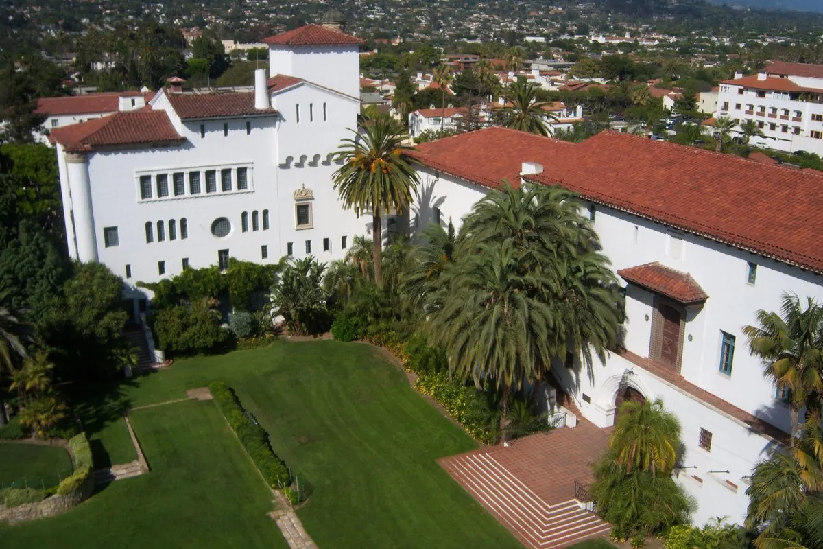
Walk down to the Santa Barbara County Courthouse, the city's landmark. The 1925 earthquake damaged its Greek Revival predecessor, and the new building, begun in 1926, was dedicated on 14 August 1929. The architect Charles Willard Moore called it the grandest Spanish Colonial Revival structure ever built; its staircases, towers and balconies are designed to evoke a castle in Andalusia. It became a National Historic Landmark in 2005.
The courthouse is still in use, with six courtrooms, but it is open to the public and a favourite for weddings. Look for the Mural Room, formerly the supervisors' assembly room, and the Hall of Records, entered through a 13-foot double door of repoussé copper depicting scenes from California's history beneath a 45-foot skylight. Less visibly, a geothermal field drilled under the lawn in 2003 heats and cools the building.
04Afternoon: State Street to the sea
From the courthouse, follow State Street, the city's main street, all the way to the water. Its shops, restaurants and arcaded buildings continue the Spanish Colonial theme, and the walk ends where State Street meets Cabrillo Boulevard.
05Sunset: Stearns Wharf
At the foot of State Street runs Stearns Wharf, built in 1872 by the lumberman John Peck Stearns. Before it, passengers and cargo had to be rowed ashore through the breakers and kelp; on completion it was the longest deep-water pier between Los Angeles and San Francisco. It has survived storms, the 1925 earthquake and two fires – one in 1973 that closed it until 1981 – and is now Santa Barbara's most visited landmark, with 17 businesses including restaurants, museums and an ice-cream parlour. A small water taxi, Lil' Toot, runs from the wharf to the harbour.
06Getting there
Santa Barbara is on US Highway 101 between Los Angeles and San Francisco, has its own airport and is served by two Amtrak lines: the Pacific Surfliner between San Diego and San Luis Obispo and the Coast Starlight between Los Angeles and Seattle. For more ideas, see our destinations, the Metro Mode camera and our list of hotels worth a single night.