In this story · 3 sections
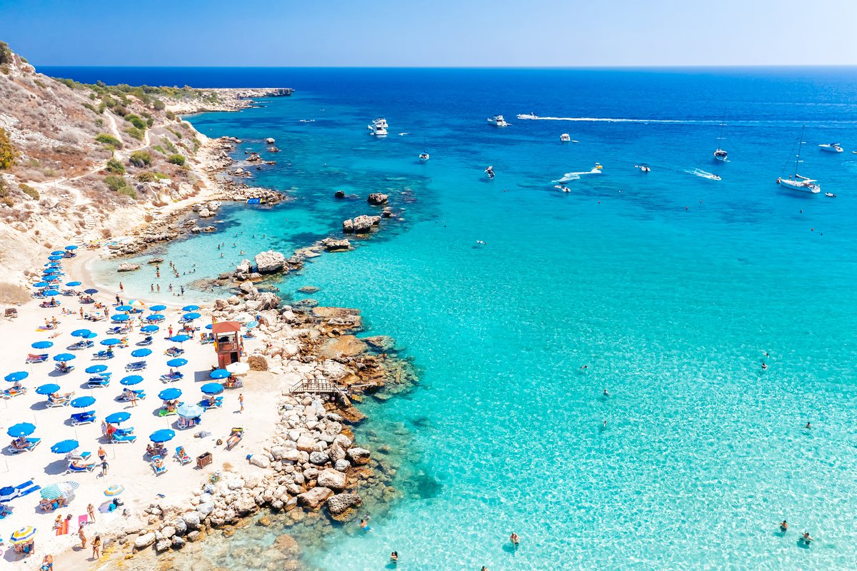
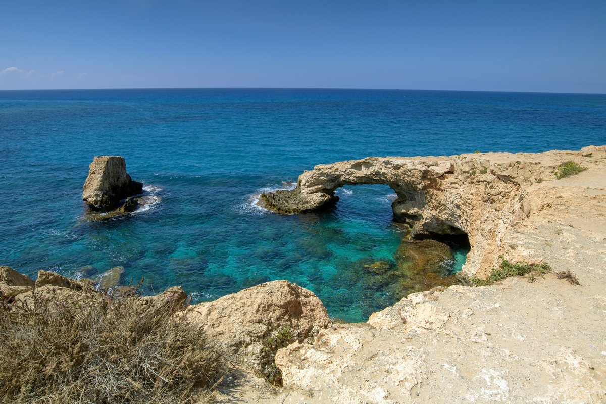
Cape Greco is where Cyprus runs out of land in the south-east. Between Ayia Napa and Protaras, a low limestone headland pushes into the sea, its cliffs undercut by the waves into caves and arches above clear water. Much of it is protected: Cape Greco National Forest Park covers 385 hectares and belongs to the Natura 2000 network of European conservation sites, with no hotels or large developments inside its boundaries. Trails lined with Calabrian pine and Phoenician juniper lead to the things people come for – the sea caves, the natural bridge of Kamara tou Koraka, the whitewashed chapel of Agioi Anargyroi above its own cave, and the scattered stones of a temple of Aphrodite. It is also, according to Wikipedia, the easternmost point of the territory controlled by the Republic of Cyprus.
Cape Greco National Forest Park
Nature park · Ayia Napa
© OpenStreetMap contributors · OpenFreeMap
- Address
- Cape Greco (Cavo Greco), Ayia Napa, Cyprus
- Open
- Park: no hours published. Information centre: 1 May–31 Oct daily 10:00–18:30; 1 Nov–30 Apr Mon–Fri 10:00–14:30
- Tickets
- No park fee published; information centre €2 (adults), €1 (ages 6–12), under-6s free
- Time needed
- 45 minutes to 2 hours per trail; half a day for caves, a trail and the centre
- Best time
- Spring for wildflowers; early morning or late afternoon in summer
- Getting there
- About 10 minutes by car from Protaras, 15 from Ayia Napa; free parking
- Telephone
- +357 23 814 412 (information centre)
- Website
- visitcyprus.com (Deputy Ministry of Tourism)
- Size
- 385 hectares, Natura 2000 site
A protected 385-hectare national forest park between Ayia Napa and Protaras, with sea caves, the Kamara tou Koraka rock bridge, the chapel of Agioi Anargyroi and four marked trails. The map point is the visitor centre car park.
01The story
In antiquity the headland was called Pedalion, and the Greek geographer Strabo wrote that the table-shaped hill above it was sacred to Aphrodite. On the Aphrodite trail, a sign marks the spot where a temple to the goddess is believed to have stood. The modern name is Italian for "Greek cape". Below the church of Agioi Anargyroi lies a sea cave where, it is believed, saints lived as ascetics; elsewhere on the cape, shepherds walled up natural caves with dry stone to keep their animals.
The twentieth century left a different mark. From 1973 a powerful Radio Monte Carlo medium-wave transmitter broadcast from the cape to the Middle East. The broadcasts ended in 2019 and, Wikipedia records, both antennas were demolished in November 2021. The latest chapter came in May 2026, when the Department of Forests put up a temporary fence around the sea caves – a response, it said, to injuries from people diving off the rocks and to a rock formation that had shown signs of instability.
02What you see
The cliffs are limestone, and the sea has worked them hard. The sea caves are the best known, with marked paths that let you look down into them from above, and boat trips pass along the foot of the cliffs. North of the caves, Kamara tou Koraka is a natural rock bridge on the coastal trail, and the little church of Agioi Anargyroi stands on the edge with steps leading down to a cave at sea level.
Insider tipA temporary fence has surrounded the sea caves since May 2026.
Away from the edge, the cape is a botanist's patch. About 400 plant species grow here, the tourist board counts, including 14 endemic and 14 extremely rare ones, and spring brings the wildflowers. Foxes, hares and hedgehogs live in the scrub, and the park is a stopover for migratory birds; Wikipedia names red-footed falcons, pallid harriers and honey buzzards passing through, while the Cyprus wheatear and Cyprus warbler breed here. The Environmental Information and Education Centre explains the coastal and marine ecosystems, with three aquariums.
Don't miss
Don't miss
- 01
The sea caves, seen from the marked clifftop paths
- 02
Kamara tou Koraka, the natural rock bridge on the coastal trail
- 03
The chapel of Agioi Anargyroi and the steps down to its sea cave
- 04
The Aphrodite trail, past the site of an ancient temple and the shepherds' caves
- 05
The three aquariums at the Environmental Information and Education Centre
- 06
A swim at Konnos Bay, where two of the trails begin
03How to visit
By car, the cape is about ten minutes from Protaras and fifteen from Ayia Napa, according to the Cyprus Mail, with several free parking areas near the viewpoints and trailheads. Public transport to the park is limited.
The tourist board publishes four marked trails, all with the lowest difficulty grade: Aphrodite, a two-kilometre loop of about an hour from the visitor centre car park; Sea Caves – Agioi Anargyroi, four kilometres and an hour and a half along the shore past Kamara tou Koraka, with a picnic site and drinking water near its end; and, from Konnos Bay, Konnoi – Agioi Anargyroi (4.8 km, two hours) and Konnoi – Cyclops Cave (1.7 km, 45 minutes).
No entrance fee is published for the park. The information centre is open daily from 10:00 to 18:30 between 1 May and 31 October, and from 10:00 to 14:30 on weekdays between 1 November and 30 April; it is closed on public holidays and charges €2 for adults and €1 for children aged 6 to 12.