In this story · 5 sections
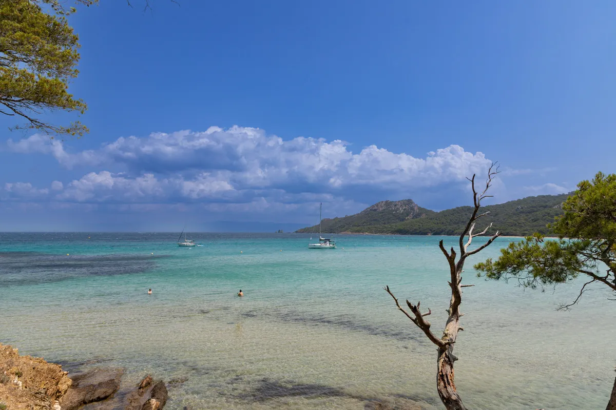
Porquerolles lies just 2.6 kilometres off the Tour Fondue, the southern tip of the Giens peninsula, and yet arriving feels like crossing into another century. The island forms an east–west arc 7.5 kilometres long and 3 kilometres wide, with some 30 kilometres of indented coast. The north shore is a run of sandy beaches backed by pines, heather and fragrant myrtle; the south, as on neighbouring Port-Cros, drops in cliffs to the sea.
Administratively it is part of Hyères. It has belonged to the French state since 1971 and has had national park status since 2012. With average summer temperatures of 25°C and winters of 11°C, it is also one of the warmest places in mainland France.
5 places
© OpenStreetMap contributors · OpenFreeMap
Greeks, monks and a gold prospector
The ancient Greeks called the Hyères islands the Stoechades, the islands in a row, and Pliny named Porquerolles Hypaea. Excavations have found a small fishing settlement of Greek colonists from Marseille in the Anse de la Galère, and Roman remains including mosaic baths. Medieval monks followed, and Benedictines and Cistercians argued over who owned the island's monastery.
The village at the head of the bay was only created from 1820, with the lighthouse following in 1837 and the church in 1850. In 1912 the island was sold to François Joseph Fournier, a mining engineer who had made his fortune prospecting for gold in Mexico after years of adventure in Canada, Panama and California. In 1971 the state acquired the 1,000 hectares of the former Fournier estate and entrusted them to the Port-Cros National Park, saving the island from development.
The beaches of the north shore
The beaches are the reason most people come, and the north coast delivers. La Courtade is the closest to the village, a pale crescent edged with pines. Further east, the Plage Notre-Dame is the one that appears on postcards, long and shallow and turquoise. To the west, the Plage d'Argent lies on the more demanding walking route towards the Calanque du Maure, and the Col du Langoustier, 43 metres up, looks down over the white and black beaches of the Langoustier.
The island is made for walking, mountain biking, swimming and diving. The park also runs talks and guided visits to the forts and estates throughout the year. Since 2020 visitor numbers in high season have been regulated, so plan ahead in summer.
At a glance
| Beach | Where | Why go |
|---|---|---|
| La Courtade | East of the village | The closest pine-fringed sand |
| Notre-Dame | North-east coast | The long, shallow classic |
| Plage d'Argent | West of the village | On the walk towards the Calanque du Maure |
Forts and a lighthouse
Above the village stands the 16th-century Fort Sainte-Agathe. Its most famous episode came in 1793, when a British admiral sheltered his fleet among the islands. The French commander, unaware of events on the mainland, invited him to dinner; while the wine flowed, British sailors landed, evacuated the garrison and blew up the fort. At the far southern tip, the lighthouse of the Cap d'Arme watches over the open sea.
Fondation Carmignac: art beneath the vines
In the 1980s the financier Édouard Carmignac bought a property of 15 hectares on the island. Building on protected land was difficult, so the architects GM Architectes Associés dug down instead, creating 2,000 square metres of underground galleries beneath the Provençal house. They opened in 2018, with gardens by the landscape architect Louis Benech.
The collection runs to more than 250 works of the 20th and 21st centuries, with a strong line in pop art: Warhol, Basquiat, Lichtenstein, Gerhard Richter, Andreas Gursky and Keith Haring among them. Works commissioned for the site include Ugo Rondinone's ring of silver heads, Four Seasons, and Olaf Breuning's giant red-haired face, Mother Nature.
On screen
Much of Jean-Luc Godard's Pierrot le Fou (1965) was filmed on and around the island, as was Mon ami Maigret (1973); both show the port and village before mass tourism. More recently, Sébastien Marnier's The Origin of Evil (2022) is set here.
Place d'Armes
The village square by the harbour
The heart of the village founded in 1820, a few steps from the port.
Place d'Armes, 83400 Porquerolles
Insider tipThe starting point for every walk and bike ride.
Fort Sainte-Agathe
The 16th-century fort above the village
Blown up by British sailors in 1793 after its commander was lured to dinner.
Chemin Sainte-Agathe, 83400 Porquerolles
Insider tipA short climb from the Place d'Armes.
Fondation Carmignac
Pop art in underground galleries
Two thousand square metres of galleries beneath a Provençal house, with gardens by Louis Benech.
Chemin Notre-Dame, 83400 Porquerolles
Insider tipCheck the season's opening dates before crossing.
Plage Notre-Dame
The island's postcard beach
A long, shallow sweep of pale sand on the north-east coast.
Plage de Notre-Dame, 83400 Porquerolles
Insider tipBring water and shade; there is little on the beach.
Plage d'Argent
The western beach on the coastal walk
On the route towards the Calanque du Maure and the Langoustier.
Plage d'Argent, 83400 Porquerolles
Insider tipCombine with the climb to the Col du Langoustier.
Property and neighbourhood data for Hyères is on VERA PI, the mainland coast continues at Bormes-les-Mimosas, and more island and coast stories are on metromode.co.