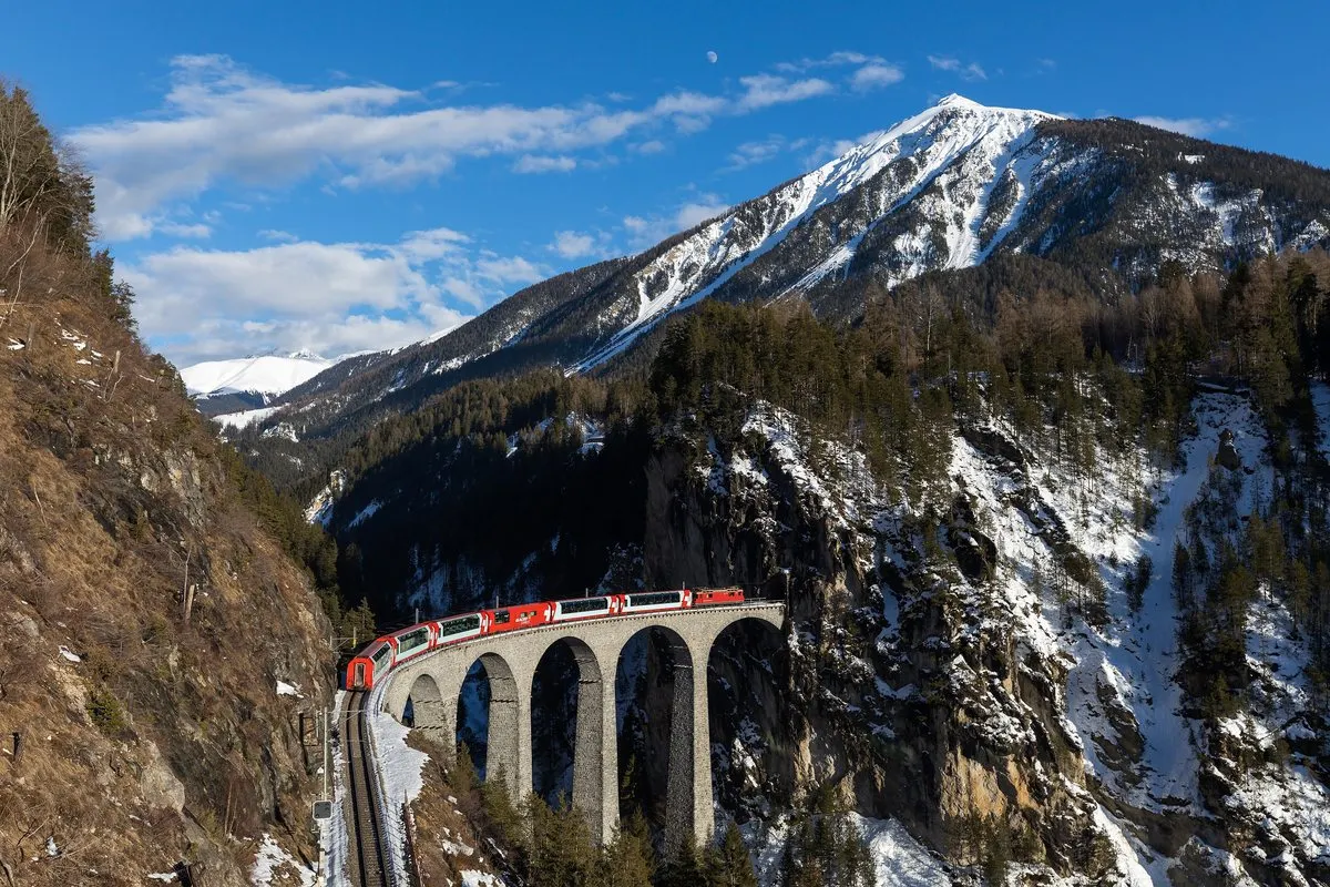
291 kilometres, 91 tunnels, over 291 bridges and eight hours through Switzerland. The Glacier Express has been called the world's slowest express train since 1930 – here is the journey from the Matterhorn to the Engadine, leg by leg.
In this story · 5 sections
The Glacier Express runs between Zermatt and St Moritz, two of Switzerland's most famous mountain resorts, through the heart of the Swiss Alps. The journey is 291 kilometres long and takes around eight hours. The train has been called the world's slowest express train, and that's exactly the point: this is not a way of getting there, but a way of seeing the country.
Along the way, the train crosses over 291 bridges and through 91 tunnels, crosses the Oberalp Pass at 2,033 metres, and follows the Rhine through one of Europe's most dramatic gorges. Since 2017, the train has been operated by Glacier Express AG, which is jointly owned by the Matterhorn Gotthard Bahn and the Rhaetian Railway. Here is the journey, stretch by stretch, from west to east.
Glacier Express in numbers
- Distance
- Zermatt–St Moritz, 291 km
- Travel time
- approximately 8 hours
- Bridges and tunnels
- over 291 bridges, 91 tunnels
- Highest point
- Oberalp Pass, 2,033 m
- Lowest point
- Chur, 585 m
- Furka Base Tunnel
- 15.4 km, all year round since 1982
01Zermatt to Brig: down from the Matterhorn
The journey begins in Zermatt at 1,606 metres, deep in the Matter Valley and just below the Matterhorn. For the first hour, the train travels down through the valley, past small villages and steep slopes, towards the great Rhone Valley in Valais. At Brig, the line turns eastwards and begins to climb again.
Anyone wanting to start the journey well-rested should spend a night in Zermatt. Our plan for 48 hours in Zermatt includes the Gornergrat and Matterhorn Glacier Paradise.
02Goms and Furka: the tunnel that opened up winter
East of Brig, the train follows the Rhone Valley up through Goms, a tranquil high valley with dark timber villages. At the end of the valley, it enters the Furka Base Tunnel, 15.4 kilometres long, which runs beneath the Furka Pass. The tunnel changed the history of the Glacier Express: until 1982, the train only ran in summer, as the passes were snowed in during winter. Since June 1982, it has run all year round.
The train was named after the Rhône Glacier near Gletsch at the Furka Pass, which the original line passed.
03Andermatt and Oberalp: the highest point of the journey
After the tunnel, the train stops in Andermatt, a village in a secluded high-alpine valley that has grown as a destination in recent years. Then the climb towards the Oberalp Pass begins, 2,033 metres above sea level, the highest point of the journey. In winter, the pass is a white landscape of snow, and in summer the train passes a small lake at the pass. This is also where the border between the cantons of Uri and Graubünden runs.
04Disentis to Chur: the Rhine and the gorge
From Oberalp, the train descends towards Disentis/Mustér and continues along the Rhine. Between Ilanz and Reichenau it passes through the Ruinaulta, the Rhine Gorge, where the river has cut down through white limestone cliffs following a prehistoric landslide. It is one of the most photographed stretches of the journey. The train then reaches Chur, the capital of the canton of Graubünden and the lowest point of the journey at 585 metres.
05The Albula Railway: the World Heritage line towards the Engadine
The final part of the journey is the most famous among railway enthusiasts. From Chur, the train climbs again, stops in Filisur – where you can change for Davos – and passes the Landwasser Viaduct, the line's most iconic structure. It then goes through the Albula Tunnel and down towards the Engadine.
A large part of the route runs through the UNESCO World Heritage Site of the Rhaetian Railway in the Albula and Bernina Landscapes. The journey ends in St Moritz, the town where winter tourism, according to tradition, began in 1864. Read the story in St Moritz and the wager that created winter tourism, and find more among metromode.co's destinations.
With the Metro Mode Camera, you can ask about every peak and viaduct you see through the window.