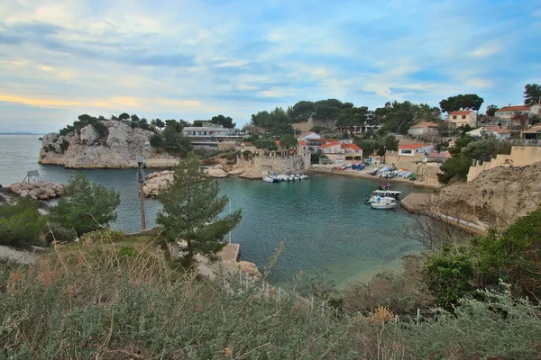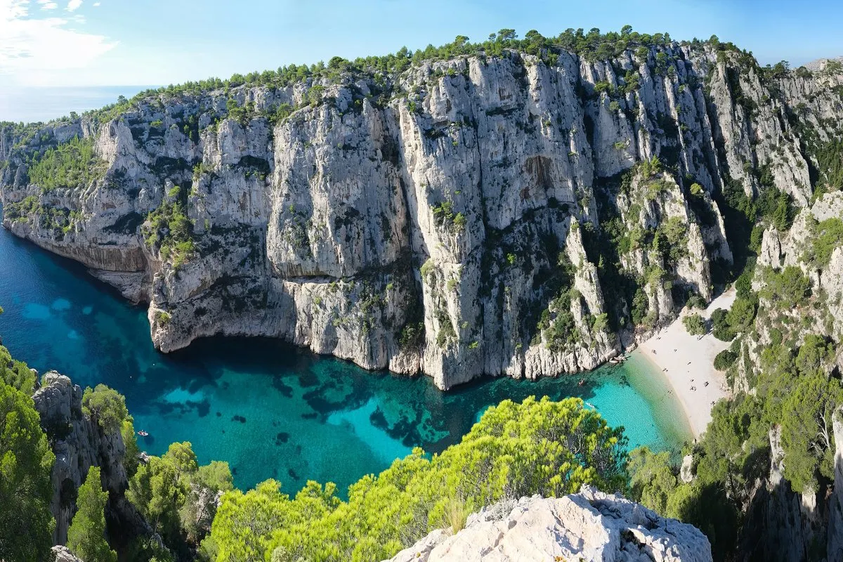
Between Marseille and Cassis, limestone cliffs drop into clear Mediterranean water. En-Vau, deeply cut and hemmed in by high walls, can only be reached on foot or by sea – which is exactly why it is worth the effort.
In this story · 5 sections
The Massif des Calanques runs along the coast from Marseille's southern arrondissements to Cassis and La Ciotat: limestone and pudding-stone cliffs, inlets cut by ancient rivers and flooded by the sea, and a scattering of islets. Since 2012 it has been the Calanques National Park, the first peri-urban national park in Europe on both land and sea. Its best-known coves include Sormiou, Morgiou, Port-Miou, Sugiton and En-Vau. For the town at the eastern gate, see VERA PI's Cassis guide.
Calanque d'En-Vau
Nature · Marseille 9e
A shingle beach between sheer limestone cliffs, reached by boat or footpath.
01A park a century in the making
Protection began at En-Vau itself. In 1923 a Comité de défense des Calanques was set up to stop industrial development there. A public body was formed in 1999 to prepare a national park, and on 18 April 2012 the decree creating it was signed. The park covers 520 square kilometres, 85 of them on land; its highest point is Mont Carpiagne, at 645 metres. Bonelli's eagle and two species of shearwater frequent the area.
02Getting to En-Vau
En-Vau lies at the south-eastern tip of Marseille's 9th arrondissement, just before Port-Pin; only Port-Miou belongs to the commune of Cassis. Its beach is shingle, the seabed alternates between sand and seagrass, and the walls around it are high and sheer. There is no road. You arrive by boat or on foot, by the red-marked path from the D559 and the Col de la Gardiole, or by the GR 51-98, marked red and white, from Cassis. Wear proper shoes and carry plenty of water.
Insider tipCheck fire-risk access rules in summer.
Film buffs will recognise the cove from the final scene of Fantômas (1964) and from Jean-Pierre Melville's L'Armée des ombres (1969).
03Summer rules
Because of the fire risk, access to sensitive massifs across the Bouches-du-Rhône is regulated from 1 June to 30 September, and the rules are updated every day. Check the prefecture's website or the official “Mes Calanques” app before you set out. Overcrowding is a real problem: since 2022 the park has run an online reservation system with visitor quotas for Sugiton and Les Pierres-Tombées in summer.
04Climbing and prehistory
The cliffs have been climbed since the British consul Francis W. Mark scaled the Grande Candelle in 1879. En-Vau's Éperon des Américains recalls the American climbers who brought free climbing here in the 1960s, and today the massif counts around 3,400 routes. Beneath the Pointe de Morgiou, the Cosquer Cave holds hand stencils some 27,000 years old and paintings of horses, bison, seals and great auks; its entrance, now 37 metres underwater, is closed to divers.
05Cassis
Cassis, about 20 kilometres east of Marseille, is the natural base. Its stone, quarried since antiquity, was used for the quays of Alexandria, Algiers and Piraeus, and its white and rosé wines were among the first three to receive an appellation d'origine contrôlée, in 1936. Cap Canaille, at 394 metres one of the highest sea cliffs in Europe, rises between Cassis and La Ciotat. For more, see VERA PI's La Ciotat guide, our Marseille page and our destination guides.