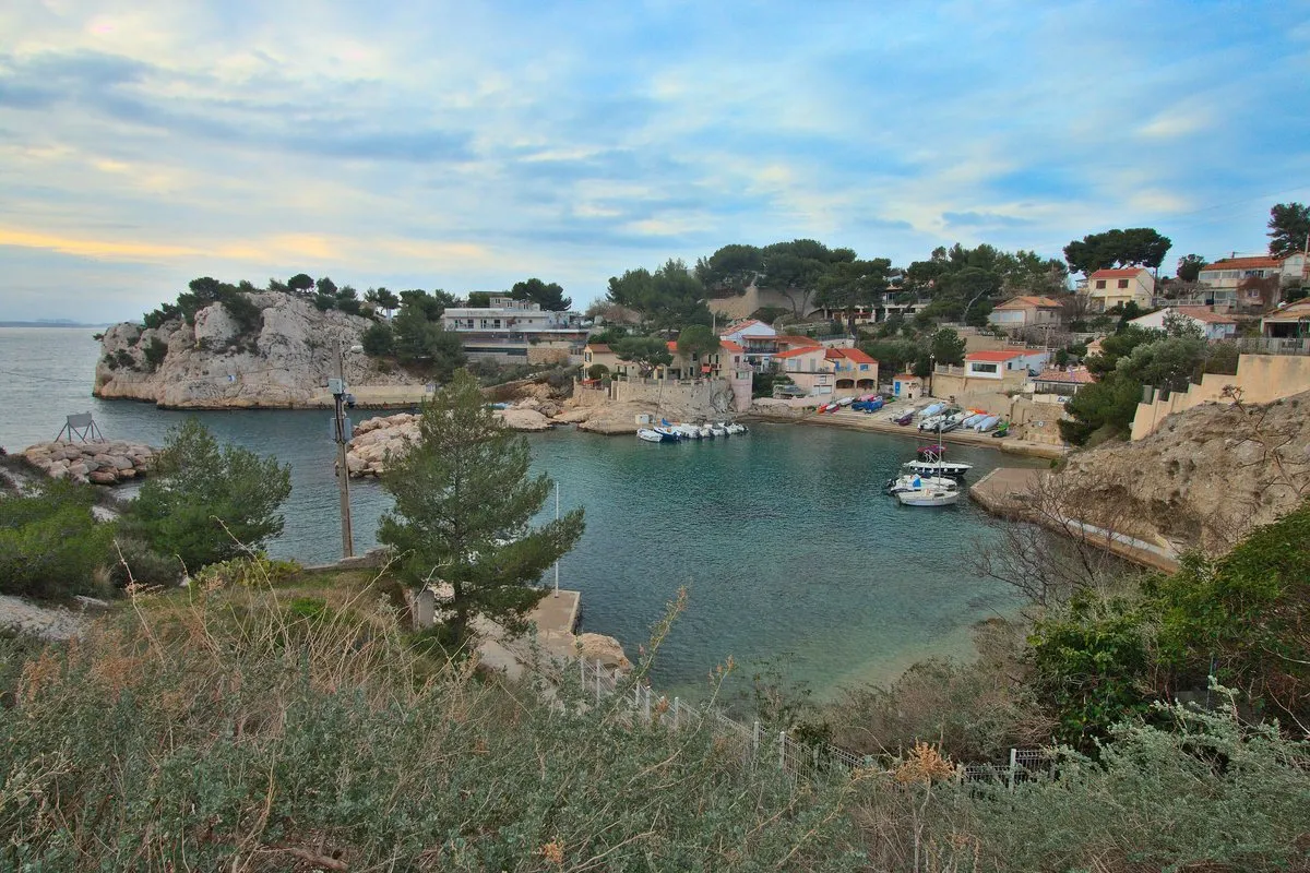
West of Marseille, the Estaque hills fall straight into a sea that gave this coast its name. No road follows the shore, but a railway opened in 1915 clings to it on viaducts and through tunnels, stopping above small harbours tucked into limestone inlets.
In this story · 4 sections
The Côte Bleue is the stretch of Mediterranean shore that runs west from Marseille to the Caronte canal at Martigues, along the communes of Le Rove, Ensuès-la-Redonne, Carry-le-Rouet, Sausset-les-Pins and Martigues. Its name refers to the colour of the water below the Chaîne de l'Estaque, and its coast is a succession of limestone calanques sheltering small ports, beaches and coves, some of them hard to reach. It is less famous than the Calanques between Marseille and Cassis, but no less striking. For the city at its eastern end, see VERA PI's Marseille guide.
2 places
A railway on the cliffs
From L'Estaque to Carry-le-Rouet, no road follows the coast; the rock drops sheer into the sea. The PLM railway company built a line along it anyway, as a relief route for the main line through the Nerthe tunnel. With no coastal plain to work with, the engineers, supervised by Paul Séjourné, hung the track on the flank of the hills. The section from Port-de-Bouc to L'Estaque opened on 15 October 1915. Over 61 kilometres the line counts 18 viaducts and bridges and 23 tunnels; the masonry viaducts of Les Eaux-Salées, Corbière and La Vesse are among the last great stone bridges built in France. Modernised in 2020–21, it is worked by regional TER trains.
From the station of La Redonne-Ensuès, above its calanque, Marseille-Saint-Charles is about 25 minutes away, with the view over the bay of Marseille along the way.
The calanques, east to west
In Le Rove come the calanques of L'Establon, La Vesse, Figuerolles, Niolon, Le Jonquier and Le Riflard; in Ensuès-la-Redonne, Le Petit and Le Grand Méjean, Les Figuières, Les Athénors, La Redonne and Le Puy; then Les Eaux-Salées and La Tuilière at Carry-le-Rouet. Beyond Le Rouet, the remaining coves towards La Couronne are not counted as calanques.
Niolon, some 20 kilometres north-west of Marseille, is the best known. It is a lived-in calanque: a handful of houses, restaurants and an inn around a harbour, with the UCPA diving centre in a fort of 1860 – one of seven national centres for training diving instructors, and the only one on the Mediterranean. The underwater sites along the coast are prized by divers. Above the village, the old Fort de Niolon looks across the bay to Marseille and the Frioul islands.
In Ensuès-la-Redonne, much of the land is protected by the Conservatoire du littoral, and 80 per cent is covered in garrigue. The calanques can be reached by car only by a single branch road that winds down the Vallon de la Graffiane between the rocks.
The Sentier des Douaniers
For walkers, the old customs officers' path follows the coast as close to the water as it can. Combined with the train, it makes an easy day: ride out, walk between two calanques and take a train back. The hills behind are covered with garrigue – kermes oak, rosemary, juniper and thyme – and are home to Bonelli's eagle and the peregrine falcon. The vegetation is sparse, so bring water and sun protection in summer.
Carry-le-Rouet
Carry-le-Rouet is a busy resort in summer, with a marina, beaches and sheltered coves. The actor Fernandel had a villa here, and since the 1950s the town has held a fête de la mer on the port over three Sundays in February. VERA PI's Carry-le-Rouet guide and its Ensuès-la-Redonne page cover the local market. For more of Provence, see our destination guides.
Niolon
A lived-in calanque
A small harbour with restaurants and the UCPA diving centre in an 1860 fort.
Gare de La Redonne-Ensuès
Station above the calanque
About 25 minutes from Marseille-Saint-Charles on the Côte Bleue line.