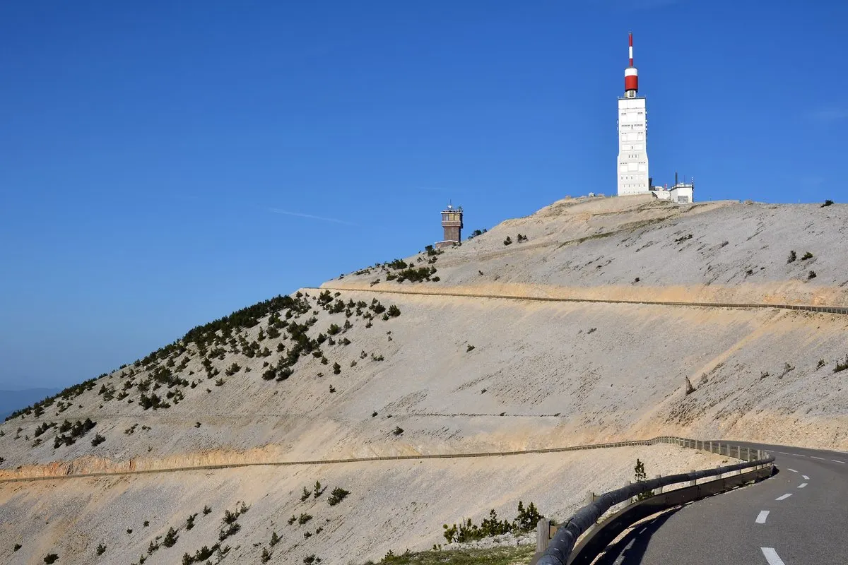
Bare and pale at the top, Mont Ventoux looks snow-capped all year from a distance. Petrarch wrote about climbing it in 1336; the Tour de France made it a legend. Here are the three roads to its 1,910-metre summit, and what to know before you take one.
In this story · 4 sections
Mont Ventoux rises alone north of the Luberon, separated from it by the Monts de Vaucluse, with the jagged Dentelles de Montmirail at its western foot. Geologically part of the Alps, it has no neighbours of similar height, so it dominates the Rhône valley and can be seen from far away on a clear day. Its summit is bare limestone, without trees, which makes it look snow-capped all year; real snow lies only from December to April. It is nicknamed the Giant of Provence, the Beast of Provence or the Bald Mountain. For the town at its southern foot, see VERA PI's Bédoin guide.
2 places
The windy mountain
Venteux means windy, and the name is earned: the wind blows across the top at 90 km/h on roughly 240 days a year, and the mistral has been measured at 320 km/h. The road is often closed in high winds, especially at the Col des Tempêtes just below the summit. The mountain was stripped of its forests from the 12th century to build ships at Toulon; replanting began in 1860, with holm oak, beech, Atlas cedar and larch. In 1990 UNESCO created the Mont Ventoux biosphere reserve, covering 810 square kilometres, and some spiders and butterflies live nowhere else.
Petrarch, a chapel and an observatory
The first recorded ascent was by the philosopher Jean Buridan before 1334, on his way to the papal court in Avignon. Petrarch described climbing it with his brother on 26 April 1336, in an account that may be partly fiction. A chapel of the Holy Cross was built on the top in the 15th century, a meteorological station in 1882 and a 50-metre telecommunications mast in the 1960s.
The three roads
At a glance
| Start | Climb | Character |
|---|---|---|
| Bédoin (south) | 1,617 m over 21.8 km, average 7.4% | The hardest; 8.9% for the last 16 km |
| Malaucène (north-west) | 1,570 m over 21.5 km | As hard, but better sheltered from the wind |
| Sault (east) | 1,210 m over 26 km, average 4.4% | The easiest; joins the Bédoin road at Chalet Reynard |
From Bédoin the first 5.8 kilometres to Saint-Estève are gentle; then the road averages almost 9 per cent before reaching Chalet Reynard, above which begins the "lunar landscape" of the summit. Trained amateurs take one and a half to two and a half hours; Tadej Pogačar set the fastest recorded time, 53 minutes 47 seconds, in the 2025 Tour de France. Riders who climb all three sides in a day can join the Cinglés du Mont Ventoux.
On the mountain stands the memorial to Tom Simpson, Britain's first professional world road champion, who collapsed and died on the ascent during the 1967 Tour de France, aged 29. It has become a place of pilgrimage for cyclists.
The villages below
Bédoin, destroyed by revolutionaries in 1794, has a large Spanish-style church built by the Jesuits in 1702. Sault, on the Albion plateau to the east, is a centre for lavender and its essential oils, its fields at their best in the flowering season. For more of the area, see VERA PI's Sault guide, its Malaucène page and our destination guides.
Mont Ventoux summit
1,910 metres
Bare limestone, a former meteorological station and a telecommunications mast, with views across the Rhône valley.
Tom Simpson memorial
1967
The British champion died near Mont Ventoux during the 1967 Tour de France.